Patagonia Area Mineral Drilling Exploration Proposals:
The Patagonia, Arizona area is presently the location of MULTIPLE mining exploration projects by foreign companies with plans for mines on public land in the Coronado National Forest of eastern Santa Cruz County, Arizona. These mine exploration proposals are within ten miles of our town center and located in the origins of our community’s drinking water.
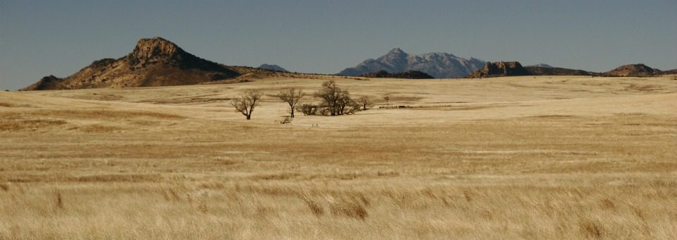
The Patagonia Area Resource Alliance recognizes that the health and economic prosperity of our community of Patagonia is tied deeply to the well-being of the Patagonia Mountains and Harshaw/Sonoita Creeks. They are the source of our water, clean air and the biological wealth drives our local economy.
The following is a summary of the mining companies with mining exploration proposals on public land in the Patagonia Mountains. Click the mining company name for more detailed information.
Regal Resources
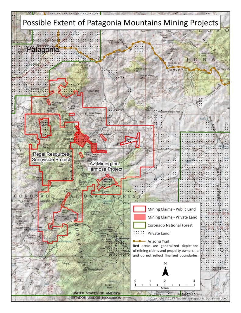
Project name: Humboldt (aka Sunnyside), proposed Mining Exploration for copper.
SIZE: 5900 acres.
LOCATION: From Alum Gulch south to Soldier Basin. See map below.
STATUSES:
- Environmental Assessment Scoping Comment Period with the Forest Service is estimated for May 2017, with the Decision and the Expected Implementation for November 2018. Link to Forest Service Sunnyside Project webpage
- PARA and Defenders of Wildlife won their litigation on September 15, 2015 against the Forest Service for the unlawful approval of the Sunnyside Proposal (Humboldt).
News Release: Conservation Wins over Exploratory Drilling in Arizona’s Mountain Empire
Arizona Mining Inc. (aka Wildcat Silver) (TSX:AZ)
Project names: Hermosa Central, proposed mining exploration to advance plans for 4,000-foot wide and 1,500-foot deep open pit mine for silver and manganese.
Taylor project, proposed underground mine for zinc, lead and silver.
SIZE: 20,000 acres.
LOCATION: Harshaw, Mowry, Guajolote Peak. See map below.
STATUSES:
- All work is being done on private mining claims. Public land mining claims are untouched.
- Scoping period for Taylor project has been CANCELLED. Link to Forest Service Hermosa-Taylor Deposit Drilling Project.
- EA CANCELLED for Hermosa Central. Link to Forest Service Hermosa Project Webpage. The release of the final Hermosa Environmental Assessment (EA) is Cancelled.
Press Release: Hermosa mine proposal could deplete southeast Arizona town’s drinking water aquifer. Peer-reviewed report outlines Hermosa pit mine’s risks of water over-consumption, perpetual water pollution to Patagonia area.
26,000 acres under mineral leases in the Patagonia Mountains
The Concern of Mining in Patagonia, Arizona
Patagonia Mining Threats: The Patagonia, Arizona area is presently the location of MULTIPLE mining exploration proposals from foreign companies with plans for mines on our public lands. These mining exploration proposals are within ten miles of our town center and located in and around the origins of our community’s drinking water, the Town of Patagonia Municipal Supply Watershed.
The 128,000-acre Sonoita Creek watershed is the municipal drinking water supply for the Town of Patagonia. Sonoita and Harshaw Creeks and their subterranean aquifers provide the only source of potable water for the Town of Patagonia with over 900 residents and over 300 private well users within a 3-mile radius of town. The shallow depth of the aquifers, combined with the nature of the soils and underlying geology, make the relationship between the surface and ground water watersheds a particularly close and interconnected one.
PARA recognizes that the human health and economic prosperity of our community of Patagonia is tied deeply to the well-being of the Patagonia Mountains and Harshaw/Sonoita Creeks. They are the source of our drinking water, clean air and the biological wealth that drives our local economy.
The pollution and related economic, social and human health impacts on the community of Patagonia would far outweigh the relative handful of jobs created by a new mining. The sustainable tourism jobs will be lost forever if our public lands are permanently destroyed by mining. In 2008, visitor spending in Santa Cruz County, Arizona amounted to 257 million dollars and accounted for over 2000 jobs. Government revenue generated by travel spending was 13.4 million dollars.*
What is a Plan of Operation and What’s a Scoping Notice?
Check out our NEPA Resources page here. NEPA is the National Environmental Policy Act and is the environmental review process by which all federal agencies must comply for federal actions that could have environmental effects.
Having your voice heard…
“The environmental review process under NEPA provides an opportunity for you to be involved in the Federal agency decisionmaking process. It will help you understand what the Federal agency is proposing, to offer your thoughts on alternative ways for the agency to accomplish what it is proposing, and to offer your comments on the agency’s analysis of the environmental effects of the proposed action and possible mitigation of potential harmful effects of such actions. NEPA requires Federal agencies to consider environmental effects that include, among others, impacts on social, cultural, and economic resources, as well as natural resources. Citizens often have valuable information about places and resources that they value and the potential environmental, social, and economic effects that proposed federal actions may have on those places and resources. NEPA’s requirements provide you the means to work with the agencies so they can take your information into account.” From the Citizens Guide to NEPA
What do all those acronyms mean??? Check out our handy Glossary of Terms!
* Arizona Travel Impacts, Dean Runyan Associates, Arizona Office of Tourism